
Multi-orbital sources
Sentinel-1 to 5, commercial LEO, EUTELSAT 8°W B, Meteosat-12, EUMETCast Africa, GPS, Galileo, GLONASS, BeiDou — normalised ingestion.

Sentinel · GNSS · Meteorologia · LEO · Dashboards
Innoving Satellite Integration connects Copernicus Sentinel feeds, EUMETSAT weather, GNSS (GPS, Galileo), satellite telecoms and LEO constellations to any business application — ERP, GIS, mobile, BI or sovereign platform — whatever your architecture (monolith, microservices, cloud, edge or hybrid).
Sentinel-1 to 5, commercial LEO, EUTELSAT 8°W B, Meteosat-12, EUMETCast Africa, GPS, Galileo, GLONASS, BeiDou — normalised ingestion.
REST/GraphQL APIs, event buses (Kafka, RabbitMQ), ETL, webhooks — integration into ERP, Odoo, SAP, mobile apps or Power BI / Grafana dashboards.
Map layers, alerts, KPIs and scenarios — weather, floods, agricultural NDVI, GSM/GNSS fleet tracking, maritime and environment.
STAC, OGC WMS/WFS/WCS, COG GeoTIFF, PostGIS, GDAL — raster/vector processing, edge ML and Africa-optimised storage.
Weather, hydrology, agriculture and monitoring — satellite feeds turned into decision visuals inside your applications.

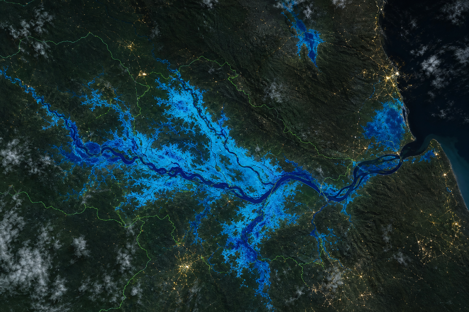
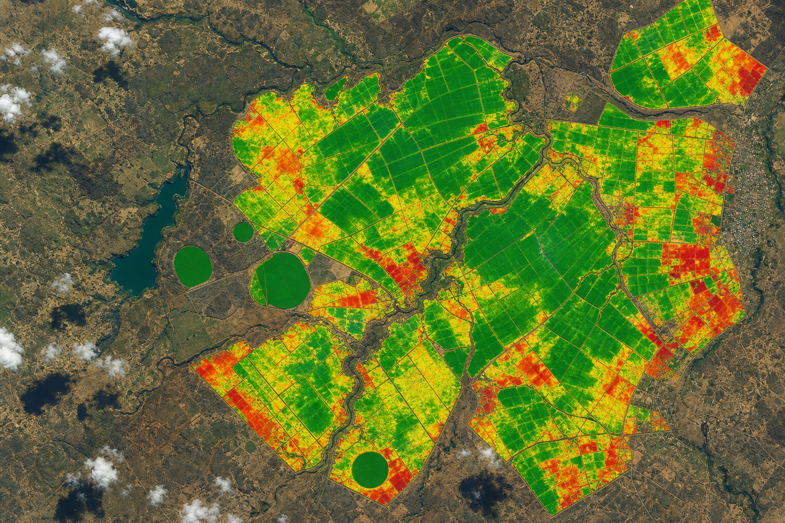
We integrate major missions and constellations — Copernicus open data, EUMETCast Africa, EUTELSAT telecoms and multi-GNSS navigation — into normalised pipelines ready for your apps.
Inondations, déformation terrain, suivi maritime, agriculture radar all-weather, urgence humanitaire
VV/VH · IW/EW · 5 m – 40 m
NDVI, cultures, foresterie, urbanisation, qualité eau, cartographie inondations optique
13 bandes · 10–60 m · revisit 5 j
Température surface mer, couleur océan, glace, feux, météo marine, niveaux eau
Optique + thermal + altimétrie
Qualité air, NO₂, O₃, SO₂, CH₄, aérosols — santé publique & climat
Spectroscopie atmosphérique
Pollution atmosphérique, monitoring industriel, feux de brousse, indices santé
UV-VIS-NIR-SWIR
Connectivité terrain, capteurs distants, backhaul d'urgence, télémetrie flottes & assets
Multi-capteurs · faible latence
Diffusion DTH, backhaul Afrique de l'Ouest, redondance liens, services broadcast & data
Couverture CEDEAO · Maghreb
Géolocalisation véhicules, traçage GSM/IoT, agriculture de précision, levés cadastraux, synchronisation SI
Multi-constellation · PPP/RTK
Nowcasting, orages, pluies intenses, prévision courte échéance, alertes early warning
FCI · 0.5 km (zone pleine disque)
Flux météo & climat en temps quasi-réel — stations, ministères, agriculture, hydrologie
EUMETSAT · Copernicus · NOAA
Séries longues, agriculture, feux, désastres, imagerie très haute résolution tasking
Selon mission · fusion multi-capteurs
Sites isolés, véhicules, navires, postes de secours — agrégation avec traçage GSM
L-band · Ka · Ku
Weather, floods, agriculture, GSM/GNSS tracking, environment and maritime — every feed becomes actionable indicators in your business tools.
Intégration Meteosat-12, EUMETCast, modèles WRF/ECMWF dans dashboards agricoles, énergie et gestion des crises.
Sentinel-1 SAR + Sentinel-2 + altimétrie — cartes d'étendue d'eau, zones à risque, simulation crues pour collectivités et ONG.
NDVI, NDWI, stress hydrique, prévision rendement — parcelles, coopératives, ministères agriculture & bailleurs.
Fusion GPS/Galileo, télématique, GSM triangulation et IoT satellitaire LEO dans une vue unique opérationnelle.
Détection feux Sentinel-3/ VIIRS, déforestation, surveillance zones protégées, reporting bailleurs & conventions.
AIS + Sentinel-1 SAR — trafic côtier golfe de Guinée, surveillance ZEE, sûreté portuaire et douanes.
We do not sell a GIS silo: we connect orbit to your existing IT — Laravel monolith, Kubernetes microservices, cloud data lake, on-prem edge or sovereign hybrid architecture.
Connectors, APIs, dashboards and industrialisation — from POC to production run with SLA and documentation.
Copernicus Sentinel-1/2/3/4/5
SAR, ótico, atmosfera e produtos derivados
Meteorologia Meteosat-12 e EUMETCast Africa
nowcasting e alertas
GNSS GPS + Galileo
rastreamento de frotas, agricultura de precisão, timing
EUTELSAT 8 West B e conectividade satelital
backhaul e IoT
Constelações LEO
telemetria, observação comercial da Terra
Dashboards meteorológicos, inundações, agricultura NDVI e ambiente
Rastreamento GSM/GNSS fusionado
logística, marítimo, segurança
APIs OGC/STAC · PostGIS · integração ERP/BI/mobile sem vendor lock-in
From available source audit to operational dashboard — with documentation, SLA and skills transfer.
Cartographie des satellites pertinents, bande passante, contraintes réglementaires, architecture cible et cas d'usage prioritaires.
Schéma d'ingestion, modèle de données, fréquences de refresh, stratégie cache/edge et contrats d'API vers vos applications.
Prototype sur zone pilote (ex. bassin Ouémé, parcelles test, corridor logistique) — validation scientifique et métier.
Déploiement production, monitoring, alerting, documentation runbook et formation équipes IT/métier.
Copernicus Sentinel-1 (SAR), Sentinel-2 (optique), Sentinel-3 (océan/météo), Sentinel-4/5P (atmosphère), constellations LEO commerciales, EUTELSAT 8 West B, Meteosat-12, flux EUMETCast Africa, GPS, Galileo, ainsi que Landsat, MODIS, VIIRS et sources commerciales (Planet, Maxar) selon le projet.
Oui — architecture agnostique : APIs REST/GraphQL, webhooks, bus Kafka/RabbitMQ, couches OGC WMS/WFS, connecteurs Odoo/SAP/Laravel/.NET et dashboards Power BI, Grafana ou Superset. Nous nous adaptons à votre stack, pas l'inverse.
Météo et nowcasting (Meteosat/EUMETCast), cartographie inondations (Sentinel-1 SAR), agriculture de précision (NDVI Sentinel-2), traçage flottes GPS/Galileo/GSM, surveillance feux et environnement, maritime AIS+SAR, et alertes early warning pour collectivités et ministères.
Prétraitement edge, tuiles COG optimisées, cache CDN, synchronisation différée et déploiement on-premise (MinIO, PostGIS, GeoServer) pour une souveraineté des données compatible avec les contraintes terrain africaines.
Oui — audit sources, zone pilote (bassin versant, corridor logistique, zone agricole), validation scientifique et métier, puis industrialisation avec SLA, monitoring et formation des équipes.
Source audit, pilot-area POC and dashboard integration — response within 48 business hours.